Friday, March 29, 2013

Thursday, March 28, 2013

2009 photos


Pictures taken on September 2009 of the abandoned grade between Palisades and the Tunnel.  All pictures looking on the up grade near milepost 18.


Wednesday, March 27, 2013


Bridge #26 looking on the up grade.  This bridge was 248' in length.  Date of photo unknown.  Here is a picture of this bridge looking on the down grade from the other side of the creek bed. 


Tuesday, March 26, 2013

Touhey just a memory


This grainy July 16, 2012 photo shows the last moments of the Touhey Elevator before a wall of fire engulfed the structure.  A large fire swept the area, thus erasing the last remaining sign that any railroad activity ever took place in Touhey.  Touhey Elevator before the fire.  Photo was taken south of the elevator.


Thursday, March 21, 2013

Bridge #18

1948 flood damage to the 170' trestle #18


Nov 2007 photo of same location and view as above.  After '48 flood the tracks were located to the west side of the creek as seen in this photo.  Bridge #18 eliminated.  Looking on the down grade.  1949 aerial of this location.


Tuesday, March 19, 2013


About a half mile down the tracks from the tunnel, this speeder and its rider, pose for a picture taken by Ryan Reed.  March 8, 1986.


Monday, March 18, 2013

Friday, March 15, 2013

Bonneville Power Spur added in 1952


Plan view drawing showing the addition of the Bonneville Power Spur (Bon Spur).  On the opposite side of the tracks across from the spur was the Moses Coulee Siding.  That siding was taken out in 1938.  This drawing is dated 1952.  This line would serve the Bonneville Power Station up until the 1980's.


2011 Aerial


Thursday, March 14, 2013


Back end of "Last Train" in Douglas.  Photo by Tim Repp.
 March 2, 1985.


Tuesday, March 12, 2013

Mansfield Depot Blueprints


Built in 1909, retired in 1944, sold and removed in 1961.  This is a revised blueprint drawing showing a proposed installation of an "Express Locker" in the ticket office.  Date 1917.


Thursday, March 7, 2013


1948 flood damage at Mile Post 22.  Looking on the down grade.  This spot is one mile up the line from McCue.


Location on aerial photo

Wednesday, March 6, 2013

Bridge #28


GNRY officials inspect the damaged remains of bridge #28 during the summer of 1948.  Looking on the down grade.  Picture provided by the Skykomish Historical Society.


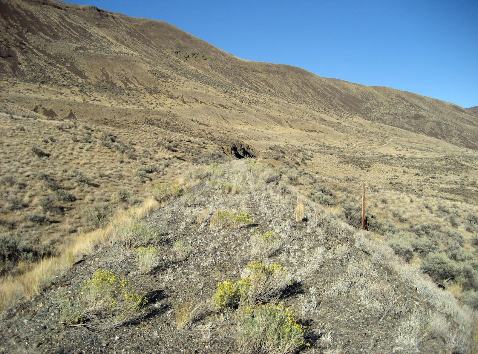
June 2012 photo showing approximate location of bridge #28.  The bridge crossed the creek just out of view if this picture to the right.  You can see where the line used to run prior to the 1948 flood on the right.   GN relocated the line to the left and eliminated this bridge completely.  I'm standing on the revised grade location looking on the up grade approximately where the basalt rock face is in the above photo.


Tuesday, March 5, 2013


Train entering the north tunnel portal at Douglas Creek Falls on the down grade.  Picture taken on October 28, 1983 by the late John P. Henderson.  Here is a picture of the train earlier that morning on the
 way up.

Monday, March 4, 2013

Mansfield in the 1950's


Looking southwest with the pump-house and depot on the left and grain elevators on the right.  Photo taken in the 1950's during the month of August.   The depot was retired in 1944 along with the water tower.  In 1961 the depot was sold and removed.  Picture of this depot in 1947.


Looking northeast towards the end of the rails.  On the left is the water crane and depot.  1950's photo.